Crater…Caldera…It’s all the same, right?

I’m afraid not, my friends. That being the case, I propose that “Crater” Lake be renamed “Caldera Lake”, which more accurately reflects its origins and current state. The lake, of course, was formed during a massive volcanic explosion, which caused Mt. Mazama to collapse and form the lake at the top. As you may recall from Geology 101, a crater is formed by an impact (think asteroid impacts that form craters on the moon)…which is not the case with “Crater” (psh!) Lake.

One of our first views of “Crater” Lake. Gorgeous, huh?

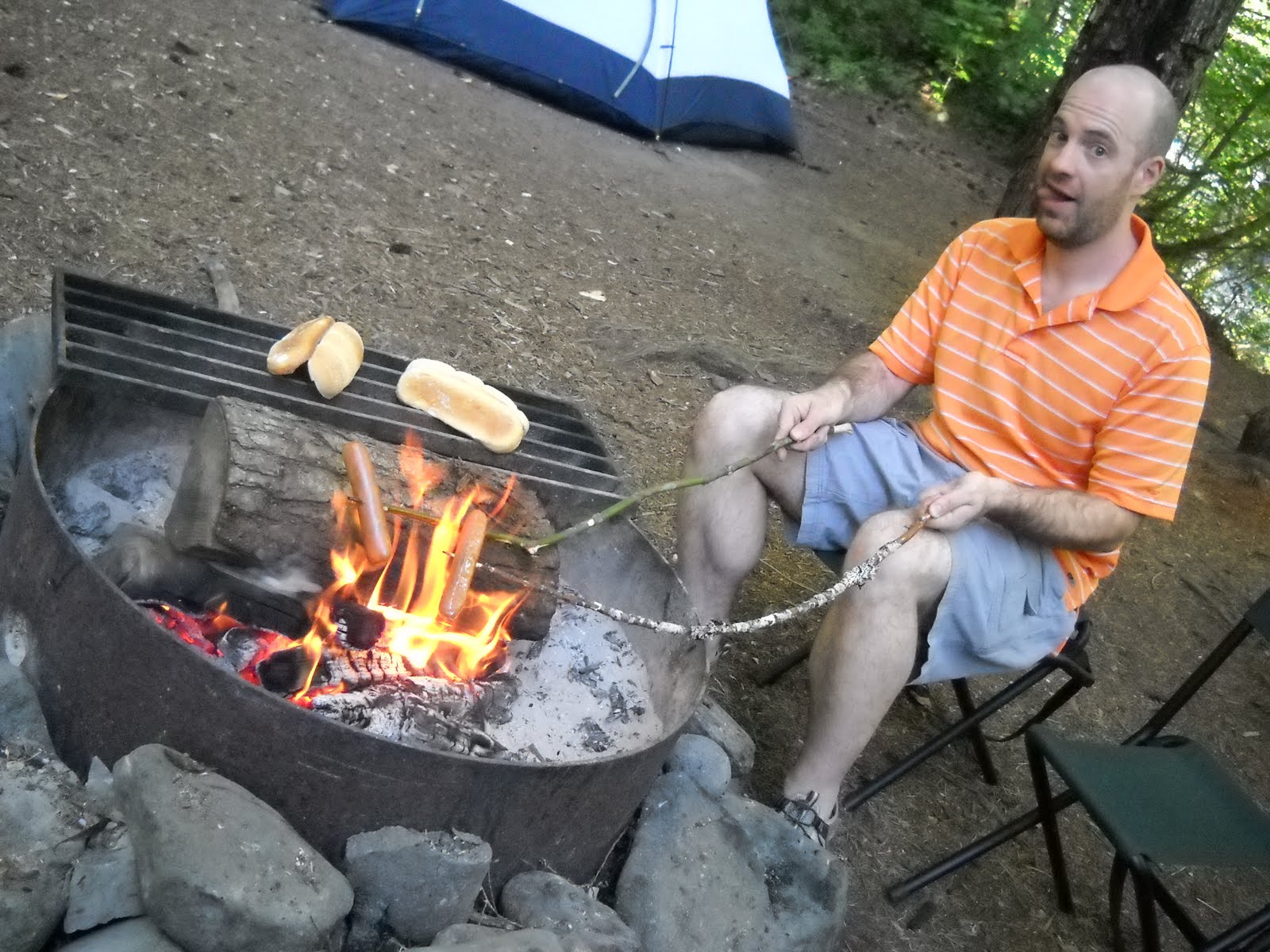
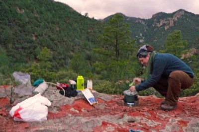
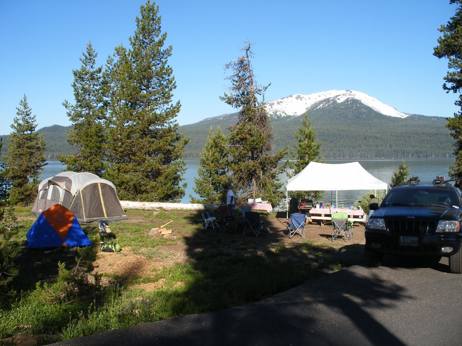
At any rate, I thought I’d share a few pictures that we took when Chris and I went on a little road trip a couple of weeks ago. We headed down south through Bend to Diamond Lake, which is just north of “Crater” Lake by about 20 minutes. We camped with some friends for a couple of nights there at the Forest Service campground. First of all, what a gorgeous place to camp! Second of all, we need a bigger tent. My backpacking tent is just not much fun for car-camping, especially when the people you’re camping with have trailers and palatial tents with separate rooms for their dogs, for Pete’s sake!

We found this sign at the Crooked River overlook. Dogs are so dumb.
Our campsite at Diamond Lake. Mosquitoes are dumb, too.
These are dragonfly nymph exuvium that I found on the shore of Diamond Lake. Dragonflies are definitely kewl. I am obviously a nerd.

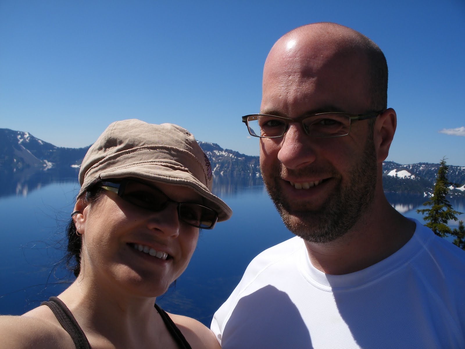
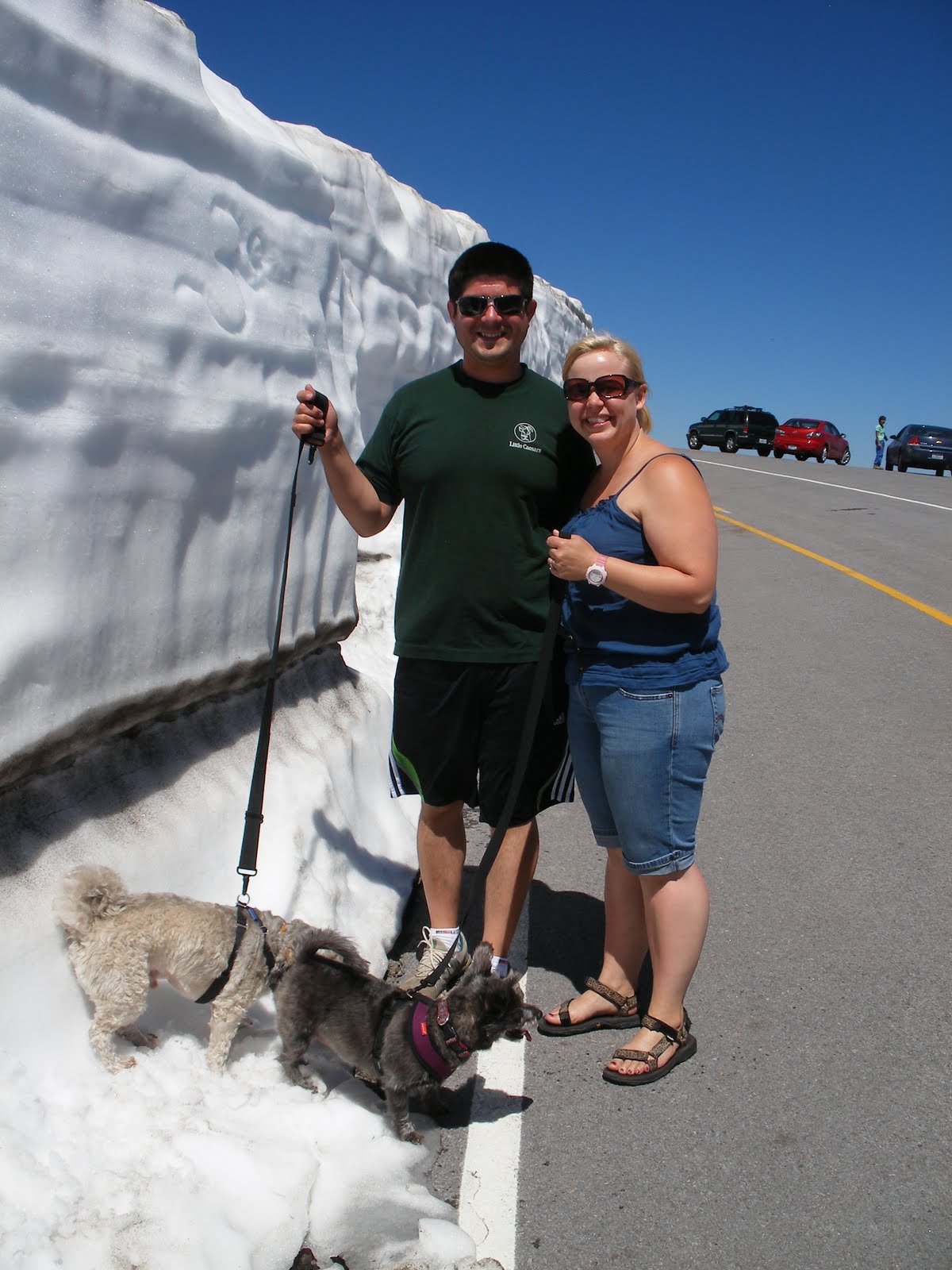
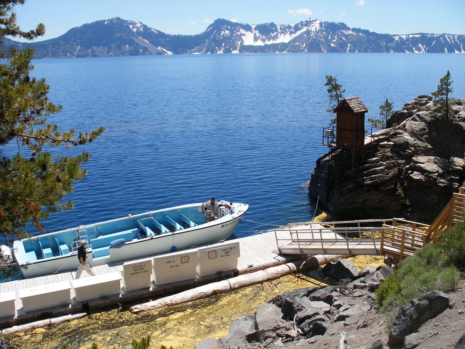
Our second day in we spent the day at “Crater” Lake. While it is misnamed, it *is* beautiful. Wowzers! And there was still plenty of snow up there. We drove around the lake, stopped at the visitor’s center so that I could get my National Parks Passport stamped (heh heh), then took the hike down Cleetwood Cove trail to the lake shore. From there, we took a 2.5 hour boat tour around the lake where our guide talked about the geology, mythology, and biology of the lake. We even got to see several hundred kokanee swimming below us at one point! They aren’t native (along with the rainbow trout), but the lake hasn’t been stocked since the 1940’s. It’s America’s deepest and most pristine lake, so removing the fish would be very difficult and the Park Service has decided to just let them persist. The hike back up the trail was not all that fun, but the weather was warm and sunny so I’m not going to complain much here.

Me and Chris at “Crater” Lake. The scenery was nice, too.
Our friends James, Becky, Wicket, and Willow. Even at the end of July the road was closed because there was still a little bit of snow around!
At the bottom of Cleetwood Cove Trail; that’s our boat waiting to take us around the lake.
Our view of Wizard Island from the lake surface. The water was really calm and clear.

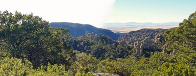
The next day we stopped at Lava Butte National Volcanic Monument (and got another passport stamp – cha-ching!) on our way back home. It’s just a few minutes south of Bend, and it pretty darn cool. We drove to the top of the butte and you can see its huge lava flow – almost 7000 years old and the pumice field looked as sharp and jagged as ever.

The forest ends abruptly at the lava flow’s edge; yes, that wall of dark brown rubble is all sharp pumice from the flow!
Chris, in front of Lava Butte.
The view from the top of Lava Butte. You can see the lava flow extending out (dark brown) and then the forest beyond. 7000 years later and the rocks have not eroded or been colonized by plants!

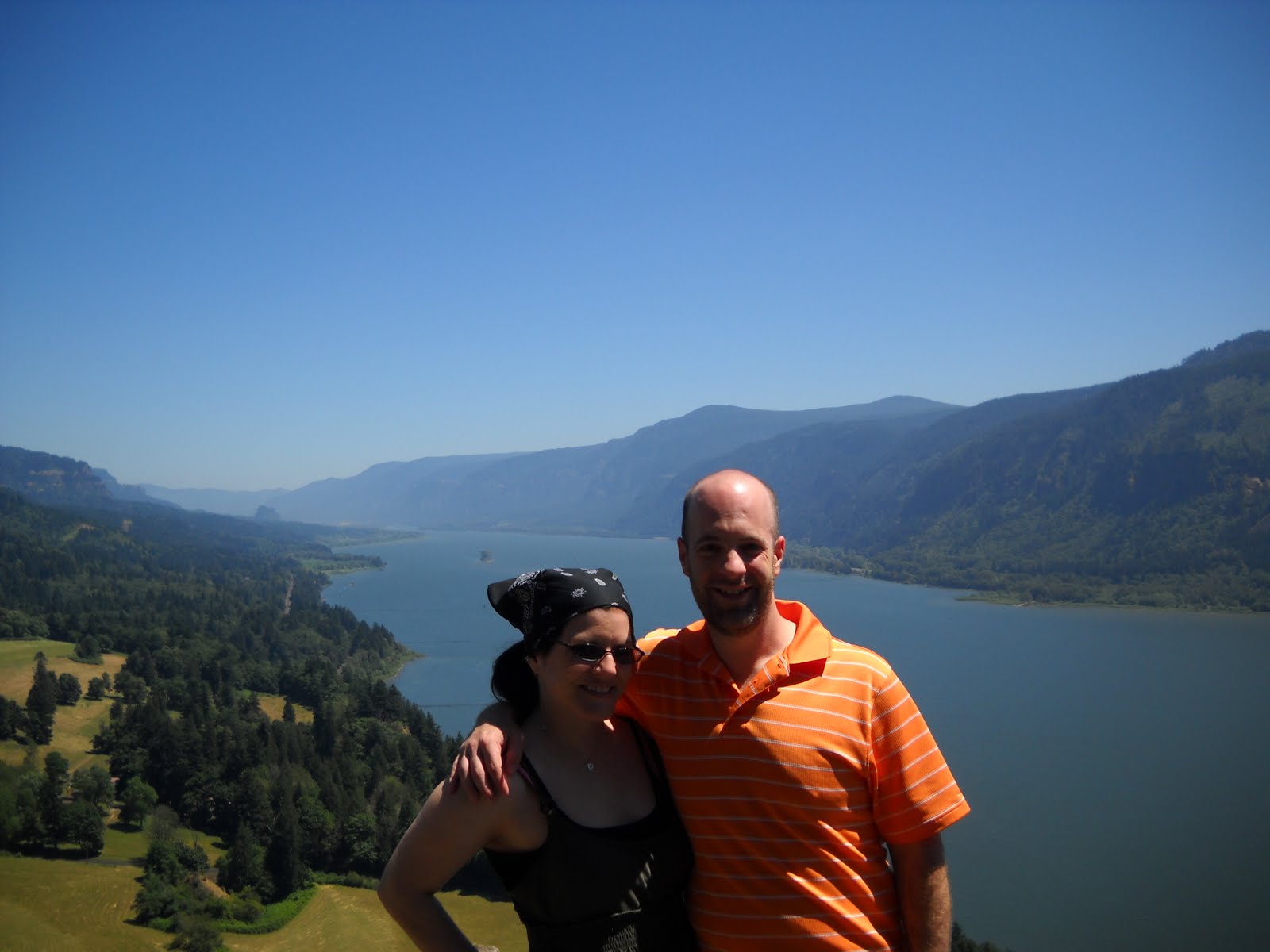
Chris had a great birthday weekend, and I decided we need to go camping more. With a new tent. And possibly a queen-sized air mattress. But first thing’s first: where to go next?

Happy birthday, my love! You are smokin’!

OMG, It’s been too long…

I can’t believe how long it had been since I’d been camping, or sleeping outside in some manner. I think I was with Cecily the last time that happened…remember that, girl? It seems so long ago! Consequently, I finally decided it was time to get back out there. Chris and I picked a special weekend (his birthday, which was July 26) and a picturesque place (recommended to me from my supervisor), packed up, and hit the road.

Our destination was the Upper Lewis River in Gifford Pinchot National Forest. We started out by driving up the Columbia River Gorge, where we had incredible views of Mt. Hood and the Columbia River.

The overlook at Cape Horn

Next, we turned north and followed the Wind River up through the national forest. We stopped at the Carson National Fish Hatchery for a quick peek (they were closed for maintenance) and then continued up further into the basin where we had a spectacular view of Mt. St. Helens. This year is the 30th anniversary of the eruption, so it was pretty dang cool seeing pictures of what it looked like before, during and after, and then the view during our trip.

Mt. St. Helens from Gifford Pinchot National Forest

We eventually picked up the Lewis River, which we followed in a general north-east direction. We stopped at Lower Falls, which was spectacular. There were signs all over the place educating people about threatened bull trout, which are in the Lewis River, and happen to be a fish I work with quite a lot in my job. It was really interesting seeing the habitat they live in – that water is cold. Brrrr!!! Anyway, the Lower Falls marks the historic end of the line for salmon returning up to spawning grounds since they couldn’t get up past the waterfall. Native Americans used to fish there when the salmon returned, but fish passage issues and depleted stocks have resulted in the absence of salmon returns there now.

View of Lower Falls on the Lewis River, Washington

We continued up the Lewis River, and after driving around for a while we finally found our targeted campground, at Twin Falls. Someone had removed the sign from the main road, so it was difficult to find. I was worried that we wouldn’t get a site (there were only 5 or so), and since the campground was free, I was sure that we’d be out of luck in the middle of camping season. But it was no problem – we got a fantastic site right on the river. Our site was down an embankment so we didn’t hear noise from any of the other campers, who appeared to be a small group of under-aged kids celebrating a birthday (Tankimus Prime, apparently) the best way they knew how – by sitting in lawn chairs in the river, drinking vast quantities of beer, and smoking lots of pot out of a hookah pipe. They were friendly though, and the river was so loud we didn’t really hear much from them.

Our campsite on the Lewis River at the Twin Falls campground.

We cooked up “better with cheddar” pork sausages, drank a bottle of wine (what were we thinking when we bought that ultra-sweet blackberry wine???), and then moved on to s’mores over the camp fire. We slept in my tent, but I don’t think either of us got very much sleep (get your minds out of the gutter people, the ground was really hard and the river was very loud!). The morning light was beautiful on the river, and we were packed up and out of there by 9:30 (the Tankimus Prime group was still passed out).

Mmmmm…pork sausage with cheese inside! Nice and crispy…

We skipped over to the White Salmon River (amazing views of Mt. Adams!), following it down through the town of White Salmon, then crossed the Columbia River to Hood River where we had lunch at Big Horse Brewery. Because it was Chris’ birthday, he had two beers and I let him eat most of my corn on the cob!

Lovely Mt. Adams
Cheers!

Our camping trip ended much too quickly, but next time I’m hoping that we’ll get to spend more than one night out in the woods. Chris has proven to be a very worthy camping partner…maybe next time we’ll try a short backpacking trip! In case you didn’t get enough, you can view more pictures by clicking here. I think that Chris had a good birthday weekend – I know I did!

Last Post of 2008! For Real This Time!!!

Lest you think that 2008 was totally in the toilet (see previous post), I thought I’d share a few more photos with you. I got a really great surprise today when I received a CD in the mail from Cecily (thanks, Cecily!!!), who compiled all the photos she took on our trip to the Chiricahuas over Thanksgiving. I’ll probably try to upload them to a Picasa web album sometime, but here are just a few of the photos that I thought were particularly funny or had incredible scenery. So happy new year, for real this time!

Thanksgiving dinner at a truck stop – bad pizza and rootbeer floats!

So this is what I look like first thing in the morning? I’d just crawled out of the tent after our first night backpacking in the wilderness area; yes, that’s ice in my hair.

One of the many spectacular views of the Chiricahua wilderness; this was just before we somehow managed to get ourselves off-trail. I wish I knew how to use the self-timer on *my* camera!

You can’t see it in the photo (how clever…), but Cecily’s ankle is totally jacked up! At this point, we were enjoying the views at the Chiricahua National Monument, which were accessible a short distance from the car.

Thanksgiving in the Chiricahuas

Since I don’t consider Thanksgiving to be one of my favorite holidays, I decided it would be a good time to get out of town for an outdoor mini-adventure. My friend Cecily, from grad school, flew into Phoenix where I drove to pick her up. We had the best Thanksgiving dinner ever – bad pizza and rootbeer floats at a truckstop outside of Tucson. Afterwards, we drove around FOREVER trying to find the Forest Service lands that we were told about so that we could camp for the night – finally, we found the turnoff for French Joe Canyon and set up for the night.

It turns out that our campsite was just next to Karchner Caverns State Park, which we explored the next day. It’s a pretty cool state park – it’s got a good museum and gift shop, although their coffee wasn’t the best. We took a tour of the Rotunda and Throne Rooms, where we saw Kubla Kahn, the biggest column known in the state of Arizona. It was pretty spectacular, although I can’t show you any pictures because there were no cameras allowed. Bummer for you!

After that, we drove east through Willcox, then took a forest service road through the Chiricahuas to the South Fork of the Cave Creek trail, just west of Portal. We hit the trailhead around 2:30, so it was a bit late; just before we got on the trail, a man approached us to tell us to be careful of all the illegal immigrants and drug smugglers coming through the area. Thanks, dude! After about a mile and a half, we turned off the Cave Creek trail and onto the Burro trail, which took us up and to the east. We didn’t get terribly far that first day because we got a late start; also, we needed to take advantage of the first flat spot we found in order to set up a tent. By the way, I need to thank my friend Glen for loaning me a bunch of ultralight equipment which reduced 20 lbs off my pack load. So if you’re in the market for a new pack or tent, go to his website, Gossamer Gear, to check out the goods!

Anyway, it was clear that others had used the same spot we found, since there were water bottles and toilet paper scattered around the perimeter of our site. I cooked up some yummy pad thai and Cecily started a fire to let all the smugglers know that we were there and not to bother us. It was a rather cold night – I didn’t get a lot of sleep because 1) I was listening for drug smugglers emerging from their hiding spots to steal our food (which they didn’t), 2) Cecily snores, and 3) it was freaking cold. We woke up to a sheet of ice on the inside of our tent, frost on our sleeping bags, and I even had frost in my hair! But a hot meal of oatmeal and peanuts and cranberries and tea warmed us up pretty good, at least while we waited for the sun to come out.

We continued on our way, up up and up the trail – and the views just kept getting more and more spectacular. We watched flocks of band-tailed pidgeons fly around below us. There were incredible rock outcrops all over the place. And the sun was out, which was in contrast from the days before. We hit Horseshoe Saddle at around noon, and there was lots of evidence that illegals had been coming through – water bottles, clothes, discarded packs, food containers, and even syringes. And unfortunately, because there was so much activity, a lot of social trails had been created, which were in fact more evident than the official trail we were trying to follow. So, at around 8000 feet, we ended up losing our trail and hiking down several fake-out trails that led us into a steep drainage.

We started bushwhacking our way down the drainage, which we knew would take us back to Cave Creek and the original trail that we were on. In my estimation, given the amount of shit in the drainage, there were approximately 359 bears in the vicinity, in addition to the drug smugglers which were surely hunkered down waiting for nightfall. Cecily and I scaled several bouldered drop-offs with few problems, but our luck didn’t last forever; Cecily fell down a 15-foot rock face and sprained her ankle really badly. But she was hard-core and didn’t cry or anything; we taped her ankle up, loaded her up with ibuprofin, and I gave her my hiking pole to hobble along on. We were only about halfway down the drainage at that point and it was starting to get dark and cold, and there was definitely no place to camp, so we decided to just try and get out that evening. I had to go ahead of Cecily and try to find the best way down the canyon drainage, which still had several rocky drops before we hit Cave Creek around dusk. But we were so happy to hear that running water!
We didn’t find the trail right away and hiked up the opposite side of the creek until I decided we needed to go back down to the creek where we would definitely find the trail at some point. Which we did – Cecily ended up hiking about 3 miles on her bum ankle, but with head-lamps and hiking poles, we made it to the car and set up camp at the Sunny Flat forest service campground. Whew! It was a good thing that Cecily brought some Vicodin with her…
The next morning, we drove back over the mountains to the Chiricahua National Monument, where the medic/ranger wrapped Cecily’s humongously swollen ankle up and provided her with ice packs and an airsplint. We drove through the monument and took in the amazing views at Massai Point. Finally, we drove back through Willcox and into Benson, where we ate a huge dinner at Apple Farm restaurant, one of the best meals I’ve ever had. The mashed potatoes were AWESOME!!! I felt like I was going to have a food baby.

We then drove back to French Joe Canyon and camped at the same spot as our first night – but this time we started a fire (with a little help from a bit of denatured alcohol, thanks) and had smores. Yummy! The following morning, we went back to our Thanksgiving day truckstop and paid $5 each for a shower. This was the first time I’ve ever had a truckstop shower, and it’s not nearly as dirty as it sounds. It was actually quite refreshing – I even managed to comb the emergent dread-locks out of my hair that had started to form during the past few days. Then, it was back to Phoenix to drop Cecily off at the airport, and then back to San Diego.
It was really a fun trip, all minor injuries aside. It was great being outside and getting my mind completely off of work for a few days, although I wish the trip could have been a little longer. I have more pictures that you can view through the slideshow link on the right side of my blog, and Cecily will be sending me her pictures as well, so there will probably be even more photos soon. It was a good Thanksgiving – even if there wasn’t any cranberry sauce involved!

My first night outside since…???

Last weekend Mark and I drove out to Anza Borrego Desert State Park, which is only about an hour and a half to the west. It was so nice out there! The weather was perfect, and getting out to the desert made me remember how much I miss it. When I was in grad school in Colorado, I usually went backpacking or camping in the Utah or New Mexico desert during spring break. Anza Borrego has spectacular wildflower blooms in the spring, but we were a few weeks early for the wildflowers. Everything was pretty green (as far as a desert can be), and we even got a rare glimpse of some desert bighorn sheep as we were driving through the mountains. We car-camped at the Tamarisk campground, which seemed to be sandwiched between two busy roads. It was fairly quiet though, except for the boy scout troop that was camped a couple sites down from ours (“Joel, get out of my sleeping bag!” and “My patrol, we’re washing all the dishes NOW!” were phrases heard several times).

Anyway, we just stayed the one night, but it was good because it has honestly been probably three or four years since I’ve spent the night outdoors. How sad. But I get to reset that clock; hopefully it won’t be too long until the next time!

Here are some pictures, but you can click on the photo album to the right to see more of my pictures of Anza Borrego.

Teddy Bear demonstrates Teddy Bear (the dog) and Teddy Bear (the cactus). We only lost one turkey burger to the campfire gods (and another to Teddy Bear).

I forgot that it gets sunny early when you sleep outside.

A nice view of the valley.